Hello all-
Not much earth shattering going on here in Spain this week. We're mostly settling into everyday life- international version, in Covid times ;-) We've been walking regularly, Scott's been cycling up into the mountains every-other day or so, and both Norma and Scott have spent about half of each day working on various projects (Norma continuing her development work for SU, and Scott working on both pencil & digital sketches).
The weather this past week was a bit on the cool and blustery side- mid-to-high 50's and mixed clouds and sun, with a smattering of rain blowing in off the Meditteranean. Our big news for the week was renting a cheap local car (a bit beat up Ford Fiesta :-), that for $340 per month, will make lots of things a bit easier/more convenieint!
One thing having a car makes possible is getting to lot's of intersting places for walks or bike rides. On Satuday, I decided to head to out to ride a set of valley's inland from Guadiaro, about 20 minutes south of here on the coast - where the terrain is not quite so dominated by mountains (I like climbing, but having no choice but to go only up or down gets old :-). With a planned loop of roughly 30 miles, I proceeded to get pretty remarkably lost on roads winding through orange groves and lined with Italian cypress & Eucaluptus. I eventually ended up about 10 miles west of where I thought I should be (thanks very much Google maps - not! Although user error was clearly part of the problem--- one does need to "zoom out" occasionally!). So after figuring out a bit more prcecisely just where I was, I started trying to head back to the car on the most direct route I could find. Sooo... one of the other shortcomings in Google maps is that it does not really differentiate much when it comes to road size or surface-- i.e., as far as Google is concerned, its either an interstate highway, or a local road. So I headed east on a promising, "numbered" road, equivalent to a county highway in upstate NY. After about 5 kilometers, it still was marked with mumber designation (CA-0575) signs, but it was getting narrower and narrower... then, it turned to hard packed gravel, and finally, sort of a well traveled goat track (still had those road signs though!)...

After stopping to again check Google for about the 10th time, and comparing that to the map on my Garmin, about 10 guys on mountain and gravel bikes rode up from the opposite direction. I managed to communicate where I was hoping to go in Spanish, they confirmed that I could eventually get to Guadiaro if I kept going "a la direcho!" :-) ...after another couple of km's, the road changed back to pavement, but turned south toward the coast, and up over a ridge... which, of course, turned out to be about the highest point anywhere on the way to Guadiano ;-) At least it meant after climbing almost 500' up, most of the rest of the way back to the car was downhill.
In addition to bike riding, we're trying to get out to enjoy a little bit of local cuisine now and then, but until it gets a bit more consistently warm and sunny, we're tending to save our pennies and eat at home (particularly with so many interesting things to try from the grocery store!). But... with the weekend, yesterday we did venture down to our nearest neighborhood "chiringuito," or beach-side restaurant/bar. It was cool, but not so much that we couldn't enjoy a glass of wine and a plate of really good fried baby squid (chipirones).
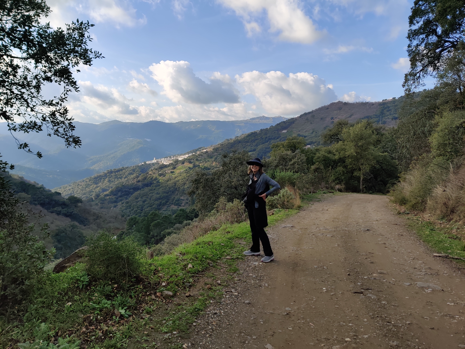
Then today (Sunday), we drove up and over the Sierra Bermeja to a really cool litle pueblo blanco, Genalguacil.
The town is set on the end of ridgeline, deep in a side-valley of the Rio Genil. After wandering the winding, cobbled medieval streets, we had a nice lunch in a tiny cafe with all of three tables on a sun-dappled terrace.
We then enjoyed a great 4 mile walk along the road through the cork oaks, olives, and flowering almond trees... absolutely gordgeous!
Until next week- Cheers!


No comments:
Post a Comment